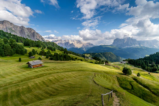
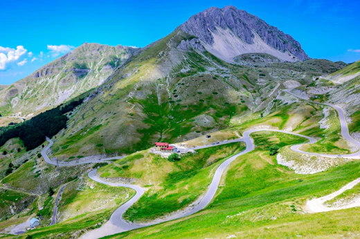
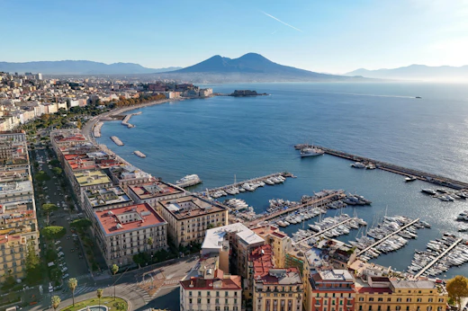
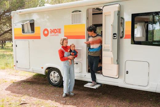
Begin your northern Italy road trip with an RV rental in Bergamo and explore a region rich with alpine views, lakeside serenity, and winding scenic routes. Visit the tranquil shores of Lake Iseo, uncover the hill towns and valleys of Lombardy, or venture into the rugged beauty of Trentino's mountain landscapes. Choose the campervan that suits your travel style from Indie Campers' flexible fleet, all with unlimited kilometers, optional one-way rentals, 24/7 online assistance, and practical extras like bedding kits, towel kits, or outdoor furniture for added comfort. With thousands of five-star reviews and a fleet built for adventure, Indie Campers is your trusted companion for exploring Italy's northern landscapes with ease.


Our Road Trips Itineraries
Bergamo's specific advantage is the scope of what is accessible from a single depot within a 75km radius and the fact that none of the primary destinations share a geographic base. The Val Camonica rock art, Lake Iseo's Monte Isola, the Franciacorta cellar doors, the Val Taleggio cheese plateau, and the Stelvio Pass eastern ramp are in completely different compass directions and different altitude bands; the only accommodation infrastructure that positions you correctly for all of them in a single continuous itinerary is a campervan. From a Bergamo or Iseo hotel, reaching the Val Taleggio producers during the 7am-9am farm gate opening and then driving to the Franciacorta Berlucchi tasting at 11am covers 80km of mountain and lowland road in a sequence that requires a vehicle at every stage and overnight accommodation in neither location.
The route that most specifically requires an RV is the Valtellina and Stelvio circuit: the combination of a Sassella terrace walk in the morning, a tasting at Nino Negri in Chiuro in the afternoon, an overnight at a Bormio campground, and an early Stelvio ascent at 7am before the cycling groups assemble at the pass is a 36-hour sequence with no hotel equivalent in the pass area that provides the same combination. The Stelvio summit is best experienced before 9am in summer, when the road is quieter and the Ortler view above the pass is unobscured by midday haze; this requires either a night before the ascent at Bormio (approximately €200-350 for a hotel room in season) or a campground pitch at approximately €22-35. The Bormio campground position within 5km of the pass base turns the Stelvio approach from a day trip from a distant hotel into a two-hour morning before breakfast, with the afternoon free for the descent and a Valtellina wine lunch at the Sassella terraces.
The cost comparison in the Bergamo network is sharpest at Lake Como: a hotel room in Varenna or Bellagio in June runs €180-450/night while the campgrounds on the Lecco branch of the lake (the same water, the same mountain backdrop, different social register) run €22-40/night. At Franciacorta, campgrounds on or near the wine estates run €22-38/night while the Relais and Chateaux properties in Erbusco run €300-700. Applied across a 10-night circuit combining the Val Brembana, Lake Iseo, Val Camonica, Lake Como, and the Valtellina, the accommodation differential typically represents €1,400-3,000 before the self-catering advantage of a Bergamo Città Alta market provisioning and Formai de Mut from the Val Brembana producers at source. For airports: Bergamo Orio al Serio International Airport (BGY, GPS 45.6736°N, 9.7040°E) is 5km southeast of the city centre, approximately 10-15 minutes from the Indie Campers depot. BGY is Ryanair's primary Italian hub and one of the top ten busiest Italian airports by passenger volume, with direct connections from London Stansted, Luton, and Gatwick, Manchester, Edinburgh, Dublin, Barcelona, Frankfurt, Amsterdam, Vienna, Warsaw, Krakow, Bucharest, and dozens of further European cities. Same-day vehicle collection after a morning arrival is logistically straightforward given the airport's proximity to the depot and the absence of any urban traffic requirement between the two.
Here's what sets Indie Campers apart from other Bergamo rental companies:
Unlimited mileage — Drive the Stelvio's 48 hairpin bends, the full Val Camonica to Capo di Ponte, and the Lake Como circuit from the Lecco approach to the Villa del Balbianello without watching the odometer. Most competitors cap you at 200-250km per day; the Bergamo-to-Stelvio-and-back circuit alone exceeds 330km before the afternoon tasting at Nino Negri.
One-way rentals to Venice — Pick up in Bergamo, drop off in Venice after a circuit through Brescia, Lake Garda, Verona, and the Dolomites. The A4 corridor from Bergamo to the Venetian lagoon is the most logistically natural east-west departure from the northern Italian network and eliminates 250km of backtracking on a route that rewards forward movement.
24/7 road assistance — Included on every booking. If something goes wrong at 2am on the SP29 above Bormio below the Stelvio, or on the SP294 in the upper Val Seriana gorge with no cell service, you have a number to call.
Basic Protection Plan included — Covered from day one. Optional upgrades available at booking.
Flexible cancellation — Cancel up to 31 days before pickup without penalty, particularly useful given the Stelvio Pass's weather-dependent opening status and the Cascate del Serio's fixed release-date schedule, both of which can shift the optimal departure window by a week in either direction.
Book now, pay later — Secure your vehicle today; full payment is not due until closer to departure.
Spring (March through May)
Temperatures: 8-20°C (46-68°F) in Bergamo city; the Alpine valleys at 600-1,000 metres run 4-7°C cooler; snow above 1,500 metres typically persists through March and recedes to above 2,000 metres by late April.
The Bergamo Prealps in spring produce specific landscape conditions that summer does not replicate: the chestnut and beech forest on the lower Orobie slopes carries new-leaf growth in a particularly saturated green that lasts from late April through May, the Val Brembana wildflower meadows are at their most varied from April through June, and the Lake Como villa gardens (Villa del Balbianello, Villa Melzi, Villa Monastero at Varenna) are at their fullest flowering from April through June. The Stelvio Pass typically opens in late May; the first open-road weeks before the cycling groups arrive in force offer the most uncrowded summit access of the year. Franciacorta cellar doors have maximum appointment availability in spring before the harvest season restructures the winemaking schedule. Val Taleggio farm gate sales begin in June; May is the earliest practical month for the plateau approach once the SP1 road clears of snow.
Best for: Lake Como villa gardens at peak flowering; the first Stelvio Pass opening weeks; Val Brembana wildflower meadows; Franciacorta cellar door availability before harvest; budget travellers before June's price step-up.
Skip if: the Cascate del Serio release days are the priority; these run from July onward.
Summer (June through August)
Temperatures: 22-32°C (72-90°F) in Bergamo; the Orobie plateau at 1,500-2,000 metres stays 12-16°C cooler and provides the primary heat escape; the Stelvio summit at 2,758 metres is actively cold regardless of lowland temperature.
Peak season for the Lake Iseo beach circuit, the Monte Isola perimeter walk, and the Franciacorta cellar doors at their most social. The Cascate del Serio release dates run from July through early September; the Bergamo summer festival season includes the Bergamo Jazz festival (March, not summer, but worth noting for spring trips) and the outdoor cinema and music programme on the Venetian walls through July and August. The Val Taleggio direct farm sales are fully operational from June through September; July and August are the period when the full rifugio network across the Orobie is open and staffed. The Stelvio Pass is at its maximum daily traffic in July and August; the most effective approach for the summit without queue is before 8am on a weekday, achievable from a Bormio campground base.
Best for: Monte Isola lake circuit; Val Taleggio farm gate sales at full operation; Cascate del Serio release day visits; all rifugi in the Orobie accessible; Stelvio Pass at maximum road season; Lake Como with full boat schedule.
Skip if: Stelvio summit access at the quietest time of year; June and September offer comparable driving conditions with significantly fewer cyclists and tour groups at the pass.
Booking note: Lake Iseo and Franciacorta campgrounds for July and August require 4-6 weeks ahead; Val Brembana campgrounds in the Foppolo and San Pellegrino area require 3-4 weeks ahead.
Autumn (September through October)
Temperatures: 12-22°C (54-72°F) through September; 6-16°C in October. The Orobie at 800-1,200 metres produces the best autumn colour in the Lombardy Alpine network from mid-October through early November.
September is the most rewarding overall season for a comprehensive Bergamo circuit. The Franciacorta vendemmia runs from late August through September (Chardonnay first, Pinot Nero typically through September, Pinot Bianco last), with cellar doors open for harvest observation and tasting at all major producers; the Berlucchi estate harvest is one of the most visually accessible in the zone and can be watched from the estate road during active picking days. The Valtellina harvest runs through September and into October; the Sassella and Grumello sub-zones' harvest is visible from the terrace walk above Sondrio. The Stelvio Pass typically remains open through October or early November depending on snow; the autumn is the most photogenic season for the 48-bend view as the larches above the hairpin sequence turn gold above the road. Lake Iseo and Lake Como are at their most atmospherically interesting in October when morning mist sits on the water surface.
Best for: Franciacorta vendemmia visits; Valtellina harvest and terrace walks; Stelvio Pass in autumn larch colour; Orobie beech forest October colour; all campgrounds open with September post-peak pricing reductions.
Skip if: the Val Taleggio direct farm sales are the priority; most rifugi close by mid-September and the farm gate sales end with the September descent of the herds to the valley.
Booking note: September Franciacorta harvest period and Stelvio closing-weekend visits require 4-6 weeks ahead; October throughout northern Italy has excellent campground availability.
Winter (December through February)
Temperatures: -2 to 8°C (28-46°F) in Bergamo city; snow above 600 metres from December; Foppolo ski area in the Val Brembana and Presolana ski area in the Val Seriana both operational from December through March, dependent on natural or machine-assisted snowfall.
Bergamo in winter is the Città Alta at its most exclusively local: the walls circuit (6km, free access year-round) in December and January carries almost no tourist pressure, the Cappella Colleoni interior is accessible without queuing at any time, and the Via Gombito delicatessens and the Enoteca Zanini are fully stocked with winter Bergamasco products including the Moscato di Scanzo (its late-harvest character makes it the natural December wine) and the aged Formai de Mut. The Val Camonica rock art sites are open year-round and are at their quietest from November through March; morning snow on the engraved rock surfaces can actually enhance the visibility of the deeper incisions. BGY airport's winter charter and low-cost traffic makes Bergamo a logical arrival point for a ski-oriented alpine circuit based at the Foppolo or Presolana areas.
Best for: Bergamo Città Alta without any tourist pressure; Foppolo and Presolana ski areas; Val Camonica rock art in winter light; Franciacorta cellar door winter releases and riserva tastings; BGY ski arrival circuit for the Lombardy Alps.
Skip if: the Val Taleggio farm sales, the Cascate del Serio, and the full Alpine rifugio network; all are closed from October through May.
The most popular months for Bergamo campervan rentals are June, July, and August.
3 to 5 Days
Three to five days covers Bergamo and the immediate circuit: the Città Alta, Lake Iseo, and Val Brembana form a natural 3-day loop within 45 minutes of the depot. Adding Val Camonica extends to a 4-day circuit without significant additional transit.
Bergamo, Lake Iseo, and Val Brembana Loop (approx. 280km, 4 days)
Day 1: Bergamo depot. Provision at the Via Gombito delicatessens. Funicolare to Città Alta: Piazza Vecchia, Cappella Colleoni, Santa Maria Maggiore. Walls circuit afternoon. Return to Città Bassa; collect vehicle. Drive to Lake Iseo via SS42 (30km, 35 minutes). Overnight near Iseo or Sulzano.
Day 2: Sulzano → Monte Isola ferry (5 minutes). Monte Isola full perimeter circuit (16km, 4 hours). Return ferry. Afternoon: Franciacorta cellar door at Berlucchi (GPS 45.6167°N, 10.0167°E). Overnight near Erbusco or Iseo.
Day 3: Iseo → SS42 north → San Pellegrino Terme → SP1 to Val Taleggio (40km from Iseo, approximately 1 hour). Morning at the Taleggio plateau farm gate (June-September season). Return to SS470 north to Piazza Brembana (15km from Sottochiesa, 30 minutes). Afternoon walk on CAI trail system above Piazza Brembana. Overnight near San Pellegrino Terme or Piazza Brembana.
Day 4: Val Brembana → Bergamo via SS470 (55km, 1 hour 10 minutes). Return depot.
Bergamo, Val Camonica, and Franciacorta (approx. 250km, 4 days)
Day 1: Bergamo depot. Città Alta morning. Drive to Lake Iseo via SS42 (30km, 35 minutes). Monte Isola afternoon ferry and village walk. Overnight near Sulzano.
Day 2: Sulzano → SS42 north → Val Camonica → Capo di Ponte/Naquane (75km from Iseo, approximately 1 hour 10 minutes from Lake Iseo). Full Naquane and Cemmo site circuit. Overnight near Capo di Ponte.
Day 3: Capo di Ponte → SS42 south → Iseo → Franciacorta circuit (40km, approximately 50 minutes). Three-stop Franciacorta cellar door circuit (Berlucchi, Ca' del Bosco, one artisan producer). Overnight near Erbusco.
Day 4: Franciacorta → Bergamo via SS42 (40km, 45 minutes). Return depot.
7 to 10 Days
Bergamo Full Alpine and Lakes Circuit (approx. 750km, 8 days)
Day 1: Bergamo depot. Città Alta morning: Cappella Colleoni, walls circuit, market provisioning. Drive to Lake Iseo (30km, 35 minutes). Monte Isola evening ferry and perimeter walk start. Overnight near Sulzano.
Day 2: Monte Isola circuit completion. Lovere: Galleria dell'Accademia Tadini. Drive north on SS42: Pisogne → Val Camonica → Naquane (55km, 1 hour from Lovere). Full Naquane and Cemmo site visit. Overnight near Capo di Ponte.
Day 3: Capo di Ponte → SS42 north → Edolo → Aprica pass → SS38 to Sondrio (70km, 1 hour 30 minutes). Sassella terrace walk and Castel Grumello. Cantina tasting in the Grumello sub-zone. Overnight near Sondrio.
Day 4: Sondrio → SS38 east → Bormio (55km, 1 hour). Afternoon provision and Bormio old town (14th-century village centre with thermal baths). Overnight near Bormio.
Day 5: Bormio → Passo dello Stelvio early ascent (7am departure from campground, summit by 8am before cycling groups). Summit walk and Ortler view. Descent. Drive south from Bormio to Bergamo via SS38 and SS36 (165km, 2 hours 30 minutes with stops). Overnight near Lecco or the Lake Como approach.
Day 6: Lecco → SP72 to Varenna (25km, 35 minutes). Varenna morning: Villa Monastero and lakefront. Ferry to Bellagio. Bellagio afternoon. Return ferry to Varenna. Overnight near Varenna or Mandello del Lario.
Day 7: Varenna → Lenno → Villa del Balbianello via western shore SS340 (40km, 55 minutes). Villa del Balbianello visit. Drive south to Bergamo via Como and A9 (90km, 1 hour 15 minutes from Lenno). Overnight near Bergamo or the Franciacorta zone.
Day 8: Bergamo → Franciacorta cellar door circuit (40km, 45 minutes). Two or three estate visits. Return to Bergamo (40km, 45 minutes). Return depot.
14 Days or More
One-Way: Bergamo to Venice via the Val Seriana, Lake Garda, Verona, and the Dolomites (approx. 800km, 14 days)
Days 1-3: Bergamo, Città Alta, Lake Iseo, and Franciacorta as per the short circuit above.
Day 4: Bergamo → Val Seriana → Cascate del Serio (if a release day; confirm before departure) via SP671 and SP294 (65km, 1 hour 10 minutes). Valbondione overnight or Val Seriana interior.
Day 5: Val Seriana → Passo della Presolana → Val di Scalve → Val Camonica → Naquane via SP294 and SS42 (80km, 1 hour 40 minutes with mountain pass crossing). Val Camonica afternoon. Overnight near Capo di Ponte.
Days 6-7: Val Camonica → Sondrio → Bormio → Stelvio Pass as per the 8-day circuit above. Overnight near Bormio both nights.
Day 8: Bormio → Stelvio summit early → descent to Prato allo Stelvio (western ramp) → SS38 to Merano (60km, 1 hour 30 minutes). Merano, the South Tyrolean spa town with its Kurhaus and the Trauttmansdorff castle garden (GPS 46.6667°N, 11.1833°E, one of the largest botanical gardens in the Alps, built around the villa where the Empress Sisi spent her convalescence in 1870-71), entry approximately €14-17/adult. Overnight near Merano.
Day 9: Merano → Bolzano → SS48 toward the Dolomites via Ora and Cavalese (90km, 1 hour 30 minutes). Val di Fiemme: the Pale di San Martino Dolomite group approaches begin here. Overnight near Cavalese or Predazzo.
Day 10: Val di Fiemme → Passo Rolle → San Martino di Castrozza → Passo Pordoi via SS50 and SS48 (80km, 1 hour 45 minutes with high passes). The Passo Pordoi (GPS 46.4833°N, 11.8333°E, 2,239 metres) is the highest point on the Sella Ronda ski circuit and commands the most famous Dolomite panorama: the Marmolada glacier to the south, the Sella massif to the north, and the Langkofel and Plattkofel to the northwest simultaneously. Overnight near Arabba or Corvara.
Day 11: Dolomite circuit: Passo Falzarego → Cortina d'Ampezzo → Passo Tre Croci via SS48 and SS51 (55km, 1 hour 30 minutes). Cortina's Piazza Venezia and the Faloria cable car. Overnight near Cortina.
Day 12: Cortina → Vittorio Veneto → Conegliano Prosecco DOCG hills via SS51 and A27 (110km, 1 hour 30 minutes). Prosecco DOCG UNESCO landscape cellar door. Overnight near Conegliano or Valdobbiadene.
Day 13: Prosecco hills → Treviso → Venice approach via A27 and the Mestre causeway (70km, 1 hour). Park at the Tronchetto island motorhome area (GPS 45.4383°N, 12.3094°E, the designated large-vehicle parking at the Venice island entrance; book at veneziaunica.it). Vaporetto to San Marco and the Rialto. Overnight at Tronchetto.
Day 14: Venice morning. Drop vehicle at the Venice depot. Fly home from Venice Marco Polo Airport (VCE).
Fuel Stations
Eni/Agip, Viale Papa Giovanni XXIII, Bergamo (GPS approximately 45.6958°N, 9.6694°E): the most practical pre-departure fill near the Bergamo depot and city centre; positioned on the main northern artery with direct access to the SS470 Val Brembana approach, the SS42 Lake Iseo approach, and the A4 motorway junction.
Q8, SS470 near San Pellegrino Terme (GPS approximately 45.8333°N, 9.6667°E, 25km north of Bergamo): the standard fill before heading deeper into the Val Brembana above San Pellegrino; the most reliable price point before the mountain road narrows and roadside station density decreases. Fill here before the SP1 Val Taleggio detour.
IP, SS42 near Iseo (GPS approximately 45.6600°N, 10.0500°E): the primary fill on the Lake Iseo circuit; positioned at the SS42 national road level before the lakeside SP510 branches off. Reliable for the pre-Val Camonica northbound fuel load; fill here to carry enough fuel for the Naquane and Edolo approach without the SS42 service area premium.
Eni/Agip, SS38 near Sondrio (GPS approximately 46.1667°N, 9.8833°E): the critical fill before the Bormio and Stelvio approach on the SS38 Valtellina corridor; roadside stations on the SS38 between Sondrio and Bormio are adequate but sparse in the upper valley. Fill in Sondrio before the 55km climb to Bormio.
Q8, SS36 near Lecco (GPS approximately 45.8564°N, 9.3978°E): the standard fill on the Lake Como approach; the SS36 between Lecco and Colico passes through several fuel stations but the Lecco junction station offers the best pricing before the single-lane SP72 lakeside road where no stations exist between Lecco and Varenna.
Northern Italy fuel note: average diesel approximately €1.78-1.95/litre; petrol approximately €1.82-1.98/litre at roadside stations. Motorway service area pricing on the A4 runs approximately €0.15-0.20/litre above roadside; the SS42, SS470, SS36, and SS38 all have competitive roadside pricing. LPG is broadly available in the Bergamo city area and in the major valley towns but disappears rapidly above 600 metres.
LPG/Autogas Refill
Eni/Agip, Via Autostrada, Bergamo (GPS approximately 45.6833°N, 9.7000°E): GPL available near the Bergamo ring road and A4 junction; the most reliable fill before any departure in any direction. Fill completely here before heading into the Val Brembana, Val Seriana, Val Camonica, or the Valtellina, where GPL coverage drops to near-zero above the valley floor.
IP, Iseo town (GPS approximately 45.6600°N, 10.0500°E): GPL available at the Iseo junction station; the most practical mid-circuit fill before the Franciacorta circuit or the Val Camonica northward; GPL availability drops sharply above Pisogne on the SS42.
GPL availability disappears on all lateral valley SP roads (SP1 to Val Taleggio, SP294 to Valbondione, SP29 to Stelvio), on the Lake Como SP72 lakeside road, and throughout the Valtellina above Tirano. Fill completely in Bergamo before departure in any direction and again in Sondrio if the Valtellina and Stelvio circuit is planned. Average LPG price approximately €0.72-0.88/litre.
Dump Stations
Area di Sosta Bergamo, near the SS42 western approach (GPS approximately 45.6833°N, 9.6500°E): motorhome service area on the western Bergamo commercial fringe, water, grey water disposal, and cassette service; the most accessible pre-departure and post-return service stop. Confirm current facilities via Park4Night.
Area di Sosta Iseo, Lake Iseo waterfront (GPS approximately 45.6600°N, 10.0500°E, near the Iseo lakefront park area): services on the Lake Iseo circuit; the primary stop for the Monte Isola and Franciacorta circuit. Confirm current facilities via Park4Night.
Area di Sosta San Pellegrino Terme (GPS approximately 45.8333°N, 9.6667°E, near the municipal car park): basic services in the Val Brembana; the standard stop before heading further north toward Piazza Brembana and the Orobie. Confirm current facilities via Park4Night.
Area di Sosta Lecco, lakefront (GPS approximately 45.8564°N, 9.3978°E, near the Lecco waterfront park): full services including EHU in season on the Lake Como approach; the primary service stop before the SP72 to Varenna and Bellagio. Confirm current facilities via campercontact.com.
Area di Sosta Bormio (GPS approximately 46.4681°N, 10.3711°E, near the Bormio thermal bath access road): the essential pre-Stelvio service stop; water, waste, and cassette services available. Confirm current facilities via Park4Night before routing specifically to this stop as mountain service areas are subject to seasonal closure.
Essential Apps
Park4Night: the primary tool for the entire northern Italian alpine network; sosta availability in the Val Brembana, Val Seriana, Val Camonica, and Valtellina is most consistently tracked here, and the offline functionality is essential above 800 metres where cell coverage becomes unreliable throughout the Orobie and Valtellina secondary road network.
Mappe.me or Google Maps offline (Lombardy and Trentino sections): download before departing from the depot; coverage is unreliable on the SP1 to Val Taleggio, the SP294 upper Val Seriana, the SS38 above Tirano, and the SP29 Stelvio approach.
stelviopass.com: current Stelvio Pass opening status, road conditions, and forecast; check the evening before any planned ascent. The pass closure information is updated daily during the May-June opening period and the October-November closing period.
Telepass app: manages the A4 and A9 motorway tolls on the Bergamo network; the A4 Bergamo-Brescia and Bergamo-Lecco-Como approaches use electronic lanes and the Telepass lane avoids the queued cash lanes on summer weekend afternoons.
Navigazione Laghi app (navigazionelaghi.it): Lake Como and Lake Iseo ferry schedules; essential for planning the Varenna-Bellagio ferry circuit and the Monte Isola Sulzano crossing with accurate timing. Confirm seasonal schedule changes at the start of May (schedule expansion) and in October (schedule reduction).
Best Campgrounds Near Bergamo
Camping del Sole — Iseo town, Lake Iseo (GPS 45.6597°N, 10.0508°E, €22-42/night, approximately 30km west of Bergamo via SS42). One of the most established campgrounds on Lake Iseo, positioned directly on the Iseo waterfront with beach access and views north up the lake toward Monte Isola and the Val Camonica Alps. Full hookups; pool; 300 metres from the Iseo town ferries. The primary base for the Monte Isola circuit and the Franciacorta cellar door loop; the lakefront position for a first or last night sets the Lake Iseo context immediately. Book 4-6 weeks ahead for July and August.
Camping Punta d'Oro — Predore, southern Lake Iseo (GPS 45.6833°N, 9.9833°E, €20-38/night, approximately 35km from Bergamo via SS42 and SP469). A beach campground on the quieter southern Lake Iseo shore between Iseo and Sarnico, with direct water access and less of the central-Iseo weekend pressure; the Franciacorta Erbusco and Borgonato cellar doors are within 10km. Full hookups; the most cost-effective Lake Iseo base in a favourable position for both the lake and the wine zone. Book 4-6 weeks ahead for July and August.
Camping la Tartufaia — near Lovere, northern Lake Iseo (GPS 45.8167°N, 10.0667°E, €20-36/night, approximately 50km from Bergamo via SS42). A campground positioned above Lovere at the northern tip of Lake Iseo, within walking distance of the Galleria dell'Accademia Tadini on the lakefront and within 20 minutes of the Val Camonica SS42 turnoff toward Naquane. The most specific base for a combined Lake Iseo northern shore and Val Camonica itinerary. Book 3-4 weeks ahead for July and August.
Camping Valbondione — Valbondione, Val Seriana (GPS 46.0000°N, 9.9500°E, €16-28/night, approximately 65km northeast of Bergamo via SP671 and SP294). Positioned directly at the Valbondione village entry, within 2km of the Cascate del Serio approach trailhead; the most specific base for a release day visit to the falls. Lower pricing than the lake campgrounds reflects the inland valley location and the absence of beach access; full basic hookups. Book 2-3 weeks ahead normally; book 4-6 weeks ahead for release date weekends.
Camping Zone — Marone, eastern Lake Iseo (GPS 45.7333°N, 10.0833°E, €22-40/night, approximately 40km from Bergamo via SS42). A campground on the lake's eastern shore at Marone, directly below the Torbiere del Sebino Nature Reserve (a protected peat bog and reed bed between Iseo and the lake, an important staging point for migratory birds on the Po Valley flyway); Monte Isola is visible across the water from every pitch. Full hookups; quieter than the Iseo-side campgrounds in peak season. Book 3-4 weeks ahead for July and August.
Camping Franciacorta — near Capriolo, Franciacorta DOCG zone (GPS approximately 45.6333°N, 9.9333°E, €20-35/night, approximately 35km from Bergamo via SS42 and SP67). A campground in the vine-covered moraine landscape of the Franciacorta production zone, positioned between the Berlucchi and Ferghettina estates; a working wine landscape surrounds the pitches and direct vineyard walks from the campground are possible during the growing season. The most specifically positioned campground for the Franciacorta cellar door circuit. Book 3-4 weeks ahead for June through September; the vendemmia period in September requires 4-6 weeks ahead.
Camping Abbadia Lariana — Lake Como, Lecco branch (GPS 45.8667°N, 9.3667°E, €22-40/night, approximately 55km from Bergamo via A4 and SS36). A campground on the Lecco branch of Lake Como between Lecco and Mandello del Lario, positioned on the lakefront with Como's signature combination of lake, cliff, and sub-Mediterranean vegetation directly accessible; Varenna is 15km north via the SP72 and Bellagio ferry is 30 minutes. Full hookups; the most practical Lake Como base for the Lecco-branch circuit from the Bergamo depot. Book 6-8 weeks ahead for July and August.
Agriturismo Camping Al Ronco — Val Brembana, near Zogno (GPS approximately 45.7833°N, 9.6667°E, €16-26/night, approximately 20km from Bergamo via SS470). A small agriturismo campground in the lower Val Brembana above Zogno, in the chestnut forest landscape that characterises the Prealpi transition between the Po Plain and the Orobie mountain proper; the most affordable base for the Val Brembana circuit with a quiet wooded setting and direct access to the SS470 northbound toward San Pellegrino. Book 2-3 weeks ahead for July and August.
Age and License Requirements
Minimum rental age: 21 years. Confirm any applicable young driver surcharge at indiecampers.com. EU license holders require no additional documentation. Non-EU visitors should carry an International Driving Permit alongside their national license; obtain it from your home country's automobile association before departure.
Credit Card and Deposit
A credit card in the primary driver's name is required at pickup. Debit and prepaid cards are not accepted. The security deposit amount varies by vehicle class and protection plan; confirm the exact figure during booking at indiecampers.com.
Alpine Pass Note
The Passo dello Stelvio, the Passo della Presolana, and other Alpine passes on the Bergamo circuit are subject to weather-dependent closures outside the standard season and to temporary road closures for cycling events (Giro d'Italia stage finishes, the Granfondo Stelvio, and the Maratona dles Dolomites each close their respective roads to motor traffic on race day). Check stelviopass.com and the relevant provincial road authority website for closure schedules before planning the ascent dates. Additionally, confirm at booking whether the rental agreement covers travel through Switzerland; the Val Chiavenna to Maloja pass route connecting Bergamo-Como to the Engadine and the Swiss national park crosses Swiss territory and requires a Swiss motorway vignette (CHF 40/year, available at border crossings and petrol stations).
National Park Passes and Pre-Booking
Italy has no unified national park pass. The Parco Nazionale delle Incisioni Rupestri di Naquane entry is approximately €5/adult, payable at the gate with no advance booking required outside school group peak periods (April-May and October, weekday mornings). The Villa del Balbianello at Lake Como requires advance booking in peak season (April through October) at fondoambiente.it; boat access from Lenno is walk-up only but fills on summer weekends before noon. The Galleria dell'Accademia Tadini at Lovere requires no advance booking. The Compendio Garibaldino on Caprera is not on this circuit. Rifugio bookings in the Orobie (Rifugio Longo, Rifugio Albani, and others) should be made at least 2 weeks ahead for July and August Saturday nights.
Reservation Systems
Book campgrounds through individual campground websites, Camping.it, or Park4Night for aree di sosta. Lake Como Lecco-branch campgrounds for July and August: book 6-8 weeks ahead. Lake Iseo and Franciacorta campgrounds for July and August: book 4-6 weeks ahead. Val Brembana, Val Seriana, and Val Camonica campgrounds: 2-3 weeks ahead is typically sufficient outside peak weekends. Cascate del Serio release date weekends: book 4-6 weeks ahead for Valbondione campground.
Toll Transponder
Confirm at pickup whether a Telepass transponder is fitted; the A4 carries toll booths at Bergamo and all major exits and the electronic Telepass lane is significantly faster at peak times. The Telepass transponder also covers the A22 Brenner motorway and the A9 Como-Lugano approach if the Stelvio circuit extends into South Tyrol or the Swiss approach via Chiavenna is included.
Speed Limits
Motorways (A4, A9, A22): 130km/h standard; 110km/h in rain; campervans over 3.5 tonnes limited to 100km/h.
National roads outside built-up areas (SS42, SS470, SS36, SS38, SS671): 90km/h standard; frequently lower in practice on the mountain approach sections and the single-lane SP72 Como lakeside road.
Urban areas: 50km/h standard; 30km/h in the Bergamo ZTL approach roads and in the historic centres of Lecco, Sondrio, and Bormio.
Average-speed enforcement (Tutor/Scout system) operates on sections of the A4 and A22; fixed cameras are present on the SS36 between Lecco and Colico.
Road Conditions
A4 (Bergamo to Milan and Brescia/Venice): six lanes for the most-used sections, well-maintained; no campervan restrictions; the busiest single motorway in Italy by freight volume.
SS42 (Bergamo to Lake Iseo and Val Camonica): two-lane national road in generally good condition; truck traffic is heavy on weekday mornings on the Val Camonica section as it is the primary commercial route to the Alpine passes.
SS470 (Bergamo to Val Brembana): two-lane, well-maintained below San Pellegrino; gorge sections above San Pellegrino narrow to 3.5m in places; suitable for campervans up to 7.5m with care.
SP1 (Val Taleggio access from Sottochiesa): narrow mountain road; suitable for compact campervans up to 6m; not recommended for vehicles over 7m.
SP72 (Lecco to Varenna, Lake Como): single-lane through village centres; suitable for campervans up to 6m; vehicles over 7m should use the SS340 western shore approach.
SS38 (Valtellina, Colico to Bormio): two-lane, well-maintained throughout; no campervan restrictions.
SP29 (Bormio to Passo dello Stelvio): two-lane mountain road with 48 hairpin bends, maximum gradient 14%; compact campervans manage the full ascent; vehicles over 8m should use the western SP134 approach or stop at Bormio.
Check current conditions at autostrade.it for A4 and A22 incidents and at the ANAS app for SS-road status; the stelviopass.com daily update is the essential reference for the Stelvio approach.
Driving Culture
Northern Lombardy drives on the right and broadly follows German-influenced driving discipline on the motorways: lane discipline on the A4 is well-observed by local traffic, overtaking is on the left, and the right lane is maintained for slower vehicles. The valley roads (SS470, SS42, SP72) carry slower-moving agricultural, delivery, and tourist traffic; the pace is set by the road rather than the posted limit on the winding sections, and any pressure to exceed this pace is counterproductive and unsafe. The SP72 single-lane Lake Como sections require patience at passing places, particularly on summer Saturday mornings when day trippers from Milan fill the road in both directions simultaneously; pull in at the nearest passing place and signal willingness to yield.
RV-Specific Notes
Height: no general height restrictions on the A4, SS42, or SS38; mountain pass tunnels carry standard profiles unrestricted for campervans up to 3.8m. Avoid any covered parking in Bergamo Città Bassa, Lecco, or Sondrio historic centres; use open surface parking universally.
Length: the SP72 Lake Como single-lane is manageable for campervans up to 6m with careful use of passing places; the SP1 to Val Taleggio is manageable for campervans up to 6m. The SS42 Val Camonica section is manageable for all vehicle sizes. The A4 motorway service areas accommodate campervans of all sizes.
Tunnels: the SS36 between Lecco and Colico passes through multiple short tunnels; all are within standard height clearances for campervans. The A4 Milan bypass tunnel sections carry no specific restrictions. LPG regulations in Italian tunnels: LPG campervans are required by Italian law to travel with the LPG cylinder valve closed when passing through tunnels over 500 metres; confirm the specific tunnel list for your route.
Alpine weather: above 1,500 metres, conditions can change rapidly even in summer; snow is possible at the Stelvio summit in any month, and the Presolana massif can receive snow above 2,000 metres from September onward. Carry a warm layer and waterproofs regardless of the valley forecast.
ZTL: applies in the Bergamo Città Alta core (enforced by cameras at the Porta Sant'Agostino and Porta San Giacomo; residents only during certain hours). Also applies in the Lecco historic centre, in Sondrio's central street zone, and in Varenna (effectively the entire waterfront is no-through-road for large vehicles). Use outer parking and walk for all historic centre visits.
Wildlife: wild boar crossings are common on the SS470 through the Val Brembana above Zogno at dawn and dusk, on the SS38 Valtellina secondary roads near Aprica, and on the SP294 upper Val Seriana. Roe deer and chamois cross the SP29 Stelvio approach above 2,000 metres, particularly in early morning. Reduce speed on unlit rural sections after sunset throughout the Orobie network.
Legal Notes
Blood alcohol limit: 0.5g/L general; 0.0g/L for drivers with less than three years' experience.
Mobile phone use without hands-free: prohibited; enforcement active at A4 police checkpoints and at urban traffic stops.
Seatbelts mandatory for all occupants in all seats.
Warning triangle and high-visibility vest compulsory in the vehicle at all times.
Winter tyres or snow chains compulsory above specific altitude thresholds from 15 November through 15 April on the Bergamo alpine road network; confirm the current year's requirements at the Provincia di Bergamo roads website before planning a late autumn or early spring alpine circuit.
Practical Logistics
Tolls
Bergamo sits on the A4 Turin-Venice autostrada, and all motorway departures from the depot accumulate toll charges. The primary toll tariffs for a Bergamo-based circuit are: A4 Bergamo to Brescia approximately €2.00; A4 Bergamo to Lecco/Como junction (exit for SS36) approximately €2.50; A4 Bergamo to Milan approximately €3.30; A4 Bergamo to Venice (full traverse) approximately €14-16. The SS42, SS470, SS671, SS36, and SS38 are toll-free national roads; a circuit weighted toward these roads and the lake approach routes keeps toll costs low. A 7-day circuit combining the Val Brembana (toll-free SS470), Lake Iseo (toll-free SS42), Val Camonica (toll-free SS42), and Lake Como (A4 to Lecco junction, approximately €2.50 one way) with a return via the SS36 (toll-free) accumulates approximately €5-10 in total motorway charges. The A22 Brenner autostrada, used for the Merano and Bolzano approaches on a longer northern circuit, carries additional tolls at approximately €10 one way Bergamo to Bolzano via the A4 and A22.
Traffic
Bergamo's ring road carries standard commuter congestion on weekday mornings (7:30-9:00am) and evenings (5:00-6:30pm) concentrated on the A4 interchange and the Viale Papa Giovanni XXIII. The SS42 westbound toward Lake Iseo builds on summer Friday afternoons as Bergamo residents head to the lake; the same road northbound toward Val Camonica is relatively uncongested year-round. The A4 eastbound toward Brescia and westbound toward Milan carries the heaviest motorway traffic in the Italian network outside Rome; avoid the A4 Bergamo to Milan section on Friday evenings and Sunday afternoons in summer if possible. The SS36 northbound toward Lake Como and Lecco builds significantly on summer Saturday mornings from the Lecco junction; departing from Bergamo before 8am on a Saturday morning reaches Varenna before the first wave of day visitors from Milan arrives.
Getting from the Airport
Bergamo Orio al Serio International Airport (BGY): GPS 45.6736°N, 9.7040°E. 5km southeast of the Bergamo city centre, approximately 10-15 minutes from the Indie Campers depot by road. Taxi to the depot approximately €12-18. The ATB city bus Line 1 connects BGY to the Bergamo train station and the Città Bassa (approximately €2, 15 minutes) for travellers using public transport to reach the depot. BGY is a compact single-terminal airport that operates at high seasonal capacity from June through September as Ryanair's primary Italian hub; allow additional time for baggage reclaim on Saturday mornings in July and August when multiple simultaneous Ryanair arrivals create temporary congestion at the single-belt baggage hall. The airport's proximity to both the A4 and the SS42 makes it logistically efficient for same-day vehicle collection with either westbound (Lake Iseo) or northbound (Val Brembana) departure on the same afternoon.
Bergamo, Lake Iseo, Val Camonica, Lake Como, and Val Brembana Circuit (approx. 650km)
RV rental: €550-1,600 (compact Adventure to large Comfort category; June through August add 25-35% at the Bergamo depot, which benefits from BGY airport's direct European connectivity and the proximity to the Lake Como and Stelvio premium circuits; book 3-4 months ahead for July and August)
Fuel: €116-127 (650km at 10L/100km = 65 litres; approximately €1.78-1.95/litre diesel; the SS42, SS470, and SS36 are toll-free national roads with competitive roadside pricing; the A4 Bergamo to Lecco junction adds approximately €2.50 one way in motorway service area premium fuel if filled there rather than at a roadside SS36 station)
LPG/Autogas: €20-40 (fill in Bergamo before departure in any direction; GPL disappears above 600 metres on all valley approaches)
Tolls: €10-25 (A4 Bergamo to Lecco/Como approximately €2.50 one way; A4 Bergamo to Brescia approximately €2.00 if the Franciacorta and Brescia approach is included; A9 Como approach approximately €2.50 if the western Lake Como circuit via the SS340 is used; total depends on how much the circuit is routed via SS versus A-roads)
Campgrounds: €112-294 (€16-42/night × 7; Val Brembana and Val Seriana inland campgrounds at the lower end €16-26; Lake Como Lecco-branch and Lake Iseo waterfront campgrounds in July-August at the higher end €32-42)
Food: €245-560 (self-catering from Esselunga or Mercato di Piazza Mercato delle Scarpe and cooking campsite casoncelli with Formai de Mut approximately €32-45/day for two; mixed campsite cooking and restaurant meals including Vineria Cozzi and one trattoria dinner approximately €55-80/day)
Activities: €25-120 (Naquane rock art Parco Nazionale approximately €5/adult; Monte Isola ferry return approximately €5/person; Campanone tower Bergamo approximately €5/adult; Villa del Balbianello garden approximately €12/adult; Franciacorta cellar door tastings approximately €15-25/person at major producers; all Venetian walls walking circuit, Val Brembana trails, Franciacorta perimeter roads, and beach access free)
Parking: €10-30 (A4 motorway service area parking free; Bergamo Città Alta outer parking approximately €2-3/hour or €10-12/day below the walls; Varenna waterfront car park approximately €2-3/hour; Stelvio summit and alpine pass car parks free or €2-3/day; campground overnight parking included above)
Budget (per couple, 7 days, vehicle rental not included): approximately €650-850 — compact vehicle, all self-catering from Mercato di Piazza Mercato delle Scarpe and Esselunga, aree di sosta and the Val Brembana/Val Camonica inland campgrounds, free activities (Venetian walls circuit, Città Alta free entry sites, Val Brembana trails, Naquane public approach viewpoints, all beaches and national park perimeters)
Mid-range: approximately €1,100-1,600 — mid-size vehicle, mix of campsite cooking and one or two restaurant meals including Vineria Cozzi and a Franciacorta cellar door tasting, mid-price Lake Iseo and Lake Como campgrounds with hookups, Naquane entry, Villa del Balbianello garden, Monte Isola ferry return, Campanone tower
Premium: approximately €2,000-3,200 — large motorhome, frequent restaurant dining including Ristorante Casual and Trattoria del Teatro, full-hookup Lake Como Lecco-branch and Lake Iseo campgrounds at peak season pricing, full Stelvio circuit with Bormio thermal baths, Valtellina Superiore and Franciacorta guided tasting programmes, Atalanta Champions League home match if dates align
Bergamo sits at the mid range of the northern Italian Indie Campers network for overall trip cost, below Lake Garda and the South Tyrol Dolomites in campground pricing but above Sardinia and Sicily. The key cost variable is how much of the circuit uses the Lake Como Lecco-branch and the Stelvio approach (which push campground prices upward) versus the Val Brembana, Val Seriana, and Val Camonica (which are among the most affordable alpine campgrounds in northern Italy). A circuit that prioritises the valleys and the Franciacorta rather than the Lake Como premium zone delivers a comprehensive experience of the Bergamo Alps and lakes at mid-range total costs, with the Val Brembana Taleggio farm gate as the most specifically rewarding free activity in the entire northern Italian network.
Bergamo → Venice (250km via A4, approximately 2 hours 45 minutes direct; 700-900km over 12-14 days via Lake Garda, Verona, the Dolomites, and the Prosecco hills) — the defining northern Italian east-west one-way, following the A4 corridor through the Po Plain's most culturally and geographically varied sequence. Fly into Bergamo Orio al Serio (BGY) and home from Venice Marco Polo (VCE); the two Ryanair hub airports on opposite ends of the A4 make this the most flight-logically natural one-way in the northern Italian Indie Campers network. Allow 12-14 days for the full circuit incorporating the Val Brembana, Lake Iseo, Lake Garda's western shore, the Valpolicella and Soave wine zones above Verona, the Dolomites via the Sella Ronda passes, and the Prosecco DOCG UNESCO hills before Venice.
Bergamo → Milan (50km via A4, approximately 50 minutes direct) — the short westward connection to the Milan depot; useful for travellers who begin the Italian circuit in the Alps and want to end in the metropolitan network, or who need to connect from BGY arrival to a subsequent Milan-based itinerary. One-way fees are the lowest in the northern Italian network on this route given the short distance.
One-way fees vary by destination and season. Confirm current availability and applicable surcharges at indiecampers.com before finalising the reservation.
Bergamo is the only Indie Campers depot in the northern Italian network where an intact UNESCO-designated medieval city at 380 metres, a working alpine cheese valley at 1,100 metres, a prehistoric rock art site with engravings from 8,000 BC, and the highest paved road in the Alps at 2,758 metres are all within a 165km straight-line radius, each in a different compass direction, and none of them sharing the logistical character of any other. Starting a circuit from Bergamo means the first day's options include everything from a Venetian Renaissance funerary chapel to a live cheese producer on an alpine plateau; the range available within the first 24 hours of a road trip is unusually broad for a city of this size and this altitude band.
The singular experience that only a Bergamo start delivers is the early morning drive from the Città Alta to the Val Taleggio plateau on a June morning, when the pre-dawn light from the Piazza Vecchia gives way to the chestnut forest corridor of the SS470 as the valley narrows north of San Pellegrino and the first cork oak trees are replaced by silver fir at 700 metres. The SP1 turnoff to Val Taleggio leaves the main road in silence at Sottochiesa and climbs through a landscape that has produced the same cheese in the same caves for 1,000 years; arriving at the first rifugio gate at 8am to buy a wheel of Taleggio fresco directly from the shepherd-producer, with the Orobie ridge above the plateau and the summer herd still in the field, is a food experience of a specificity that no restaurant or market in Bergamo's Città Alta can replicate because it is inseparable from the altitude, the season, and the direct producer relationship that the road trip makes possible.
The morning of departure: the Pescheria Vecchia market opens at 7:30am on the Via Gombito in the Città Alta; buy fresh casoncelli from the pasta vendor (they are made the previous evening and sold cold, ready for that night's campsite burro fuso, at approximately €8-12 for four portions), a 300g wedge of Formai de Mut stagionato from the cheese stall, and a small bottle of Moscato di Scanzo from the wine vendor. Take the Funicolare Città Bassa down to the lower city, collect the vehicle, and take the SS470 north. San Pellegrino Terme's Belle Époque Grand Hotel appears above the road at 25km, the first visible sign that the Prealpi have begun in earnest; at 35km the road enters the gorge section between the valley walls and the Bergamo Alps' true character becomes apparent. By the time the Sottochiesa junction appears for the Val Taleggio SP1 turnoff, the Po Plain and the city are invisible behind the valley bends and the road has become exclusively the Alps.
In general, a special licence is not required to rent our RVs in Milan Bergamo. However, a valid driving license is required to operate our vehicles. For some non-EU citizens, a IDP is required, in addition to their home country's drivers licence. Other considerations such as a valid vehicle licence to the vehicle type (manual or automatic) will also be required. For more information regarding our licence requirements read this.
Yes, our RVs are pet-friendly. Just make sure to purchase the extra cleaning service during your booking. This service includes professional anti-allergic cleaning after your trip. Please note that only one pet is allowed per motorhome, and it must weigh no more than 30kg. Keep in mind, we are not responsible for any legal fees related to traveling with your pet. For marketplace bookings, check the "vehicle rules" section for the pet-friendly icon to confirm if pets are allowed in that specific vehicle.
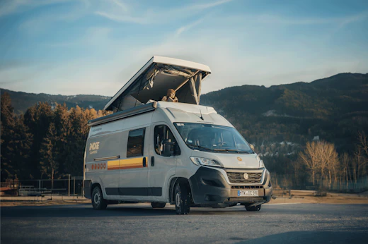
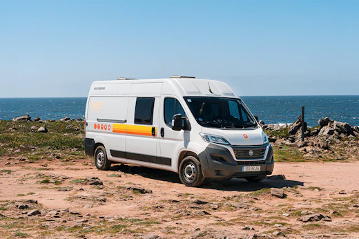
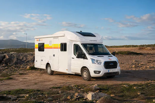
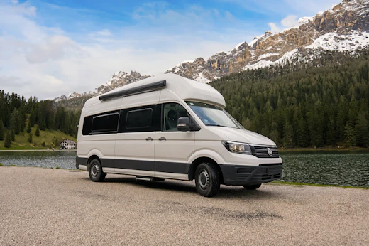
The number of people who can sleep in our RVs will depend on the size of the vehicle and the model. In general, our class C motorhome models can sleep up to 4-8 people, whereas our class B motorhomes can sleep up to 2-4. For cars with a rooftop tent, around 2 people can sleep in this vehicles. More details on our models and sleeping capacities can be found here.
If you are travelling in an RV, motorhome or caravan around Milan Bergamo, it is important to understand official camping rules of the country you are visiting. As natural areas are generally protected by laws, using an official campsite or designated overnight parking area is highly recommended. This helps protect local communities and ensures you can all enjoy safely. Read more safety tips and protocols here.
We offer three protection plans to cover incidents and damages during your rental period. All Indie Campers motorhomes come with insurance for third-party vehicles and property damage (valid insurance will depend on the country). For marketplace vehicles, insurance options may vary based on the host.
Learn more about our protection plans here.
Yes, our search filter allows you to find an RV near your location using a 60km radius system. This means depending on the location you are searching from, you will be able to find an Indie campervan rental pick-up center near you.
Yes, a selected number of Indie Campers RV rentals in Milan Bergamo include unlimited mileage, allowing you to explore freely and make the most of your road trip! Please note that unlimited mileage applies exclusively to Indie Campers RVs and is subject to responsible use.

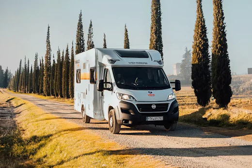
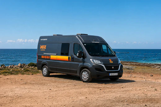
RVs, Motorhomes & Campervans for Every Kind of Traveller

/night

/night
/night
/night

/night
/night

/night

/night

/night
/night
/night

/night
/night
/night
Our Road Trips Itineraries
“Exceptional, great camper. The only point that could be improved is the space in the cabinets.”
“We have enjoyed our trip to Tuscany so much. It has been a wonderful experience, we will definitely do it again!”
“It was perfect. Thank you so much!”